News
Since Feb. 28, at least 1,000 civilian ships in the waters of the Persian Gulf have encountered navigation difficulties due to large-scale GPS disruptions. The development, picked up from maritime monitoring data and sharp “jumps” in the routes depicted on electronic maps, was shared with The Insider by analysts from the Starboard Maritime Intelligence service.
The specialists said there are signs of the substitution of navigation signals, causing vessels to receive incorrect coordinates. In a number of cases, routes on automatic identification systems (AIS) are displayed as straight lines crossing open water — and even land — indicating interference with satellite navigation.
The disruptions are linked to the active use of electronic warfare (EW) systems by coastal states in the region — not necessarily only Iran, but possibly also the United Arab Emirates and Qatar. Jamming and signal distortion could potentially complicate military strikes carried out using satellite-guided weapons.
The UKMTO is the United Kingdom Maritime Trade Operations, a British maritime-security coordination service and Royal Navy-linked contact point for merchant shipping. It acts as a liaison between commercial vessels and regional military/security forces, provides security updates, and receives ship reports in high-risk waters such as the Persian Gulf, Arabian Sea, and Indian Ocean.
MSCIO is the Maritime Security Centre – Indian Ocean, an EU maritime-security coordination center linked to EUNAVFOR. It serves as an interface between European naval forces and the shipping industry — collecting, analyzing, and sharing maritime-security information for vessels transiting the region.
GNSS stands for Global Navigation Satellite System. It is the umbrella term for satellite positioning systems that let users determine location, speed, direction and timing. GPS, Russia’s GLONASS and China’s BeiDou are all GNSS systems.
AIS stands for Automatic Identification System. It is a ship-tracking and identification system used in maritime navigation. Ships transmit and receive data such as identity, position, course and speed, helping nearby vessels and shore authorities monitor traffic and improve safety.
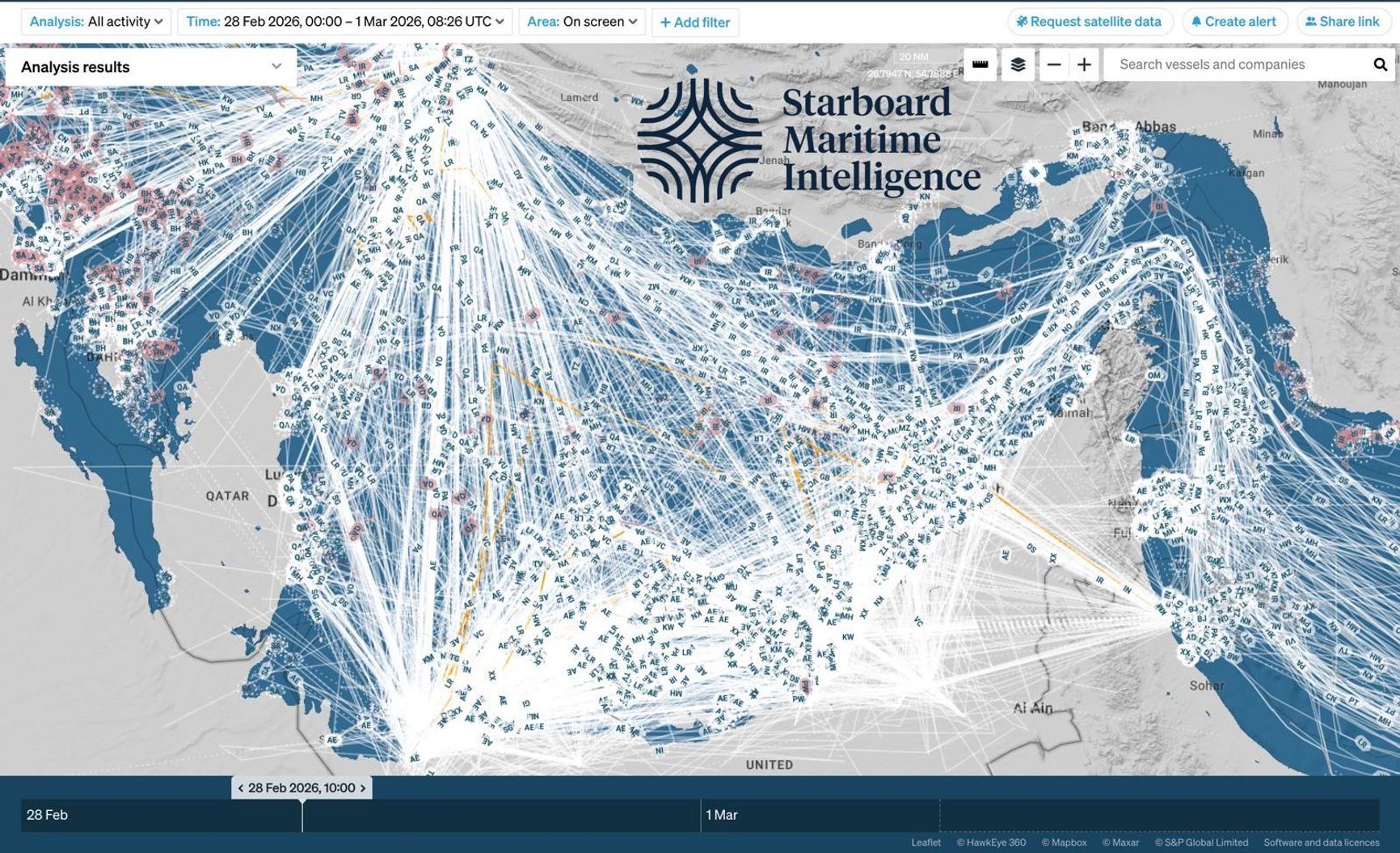
Straight lines indicate interference with satellite navigation
Starboard Maritime Intelligence for The Insider
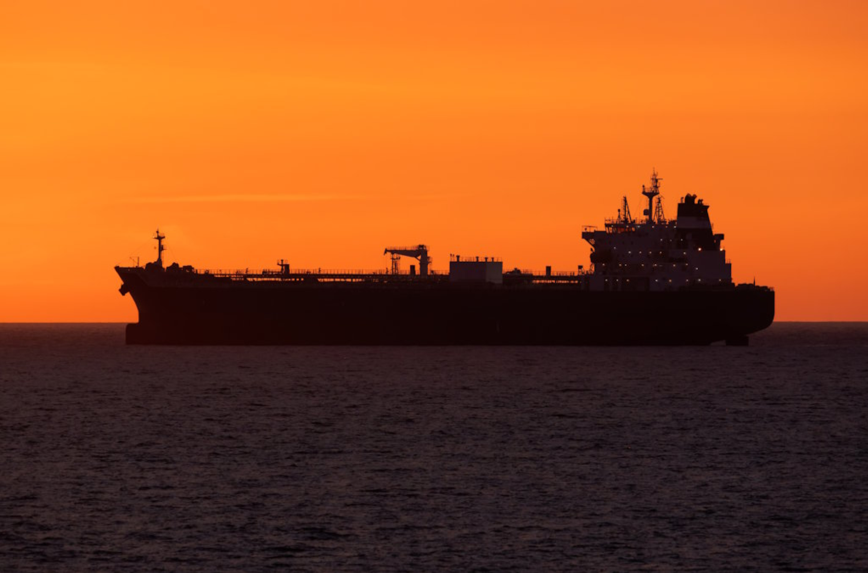
Over the past 24 hours, at least two ships in the region have been attacked:
- SKYLIGHT (IMO 9330020), a tanker flying the flag of Palau, was attacked 5 nautical miles north of Khasab, Oman. The crew was evacuated. Four people were reported injured.
- MKD VYOM (IMO 9284386), a tanker flying the flag of the Marshall Islands, was hit by a projectile above the waterline. The resulting fire was brought under control.
There were also reports of a possible strike on the tanker SEA LA DONNA (IMO 9380532), but that information was not confirmed.
Threat level: critical
The incidents confirm the continuing threat of missile and drone attacks in the Strait of Hormuz and its approaches. The Joint Maritime Information Center (JMIC) issued a report (made available to The Insider), assessing the situation in the waters of the Gulf of Oman as “critical,” raising the marker from “severe.” The report was prepared jointly with the UKMTO and MSCIO.
JMIC analysts note that increased vessel clustering is expected near UAE ports, along Omani approaches, and in anchorages of the Strait of Hormuz as operators delay transits pending further clarity. Higher traffic density may create additional navigation risks, including restricted maneuvering space, anchor dragging, and the risk of collisions.
JMIC also points to significant interference with GNSS. Positional offsets, AIS anomalies, and intermittent signal degradation have also been observed.
The JMIC forecasts that for the next 24-48 hours:
- The threat of aerial missile and drone attacks will persist.
- The risk of collateral damage remains high.
- All merchant vessels, regardless of flag or nationality, are at risk.
- No recognized authority has declared a formal closure of the Strait of Hormuz.
- The risk of mine deployment remains a key factor.
The UKMTO is the United Kingdom Maritime Trade Operations, a British maritime-security coordination service and Royal Navy-linked contact point for merchant shipping. It acts as a liaison between commercial vessels and regional military/security forces, provides security updates, and receives ship reports in high-risk waters such as the Persian Gulf, Arabian Sea, and Indian Ocean.
MSCIO is the Maritime Security Centre – Indian Ocean, an EU maritime-security coordination center linked to EUNAVFOR. It serves as an interface between European naval forces and the shipping industry — collecting, analyzing, and sharing maritime-security information for vessels transiting the region.
GNSS stands for Global Navigation Satellite System. It is the umbrella term for satellite positioning systems that let users determine location, speed, direction and timing. GPS, Russia’s GLONASS and China’s BeiDou are all GNSS systems.
AIS stands for Automatic Identification System. It is a ship-tracking and identification system used in maritime navigation. Ships transmit and receive data such as identity, position, course and speed, helping nearby vessels and shore authorities monitor traffic and improve safety.